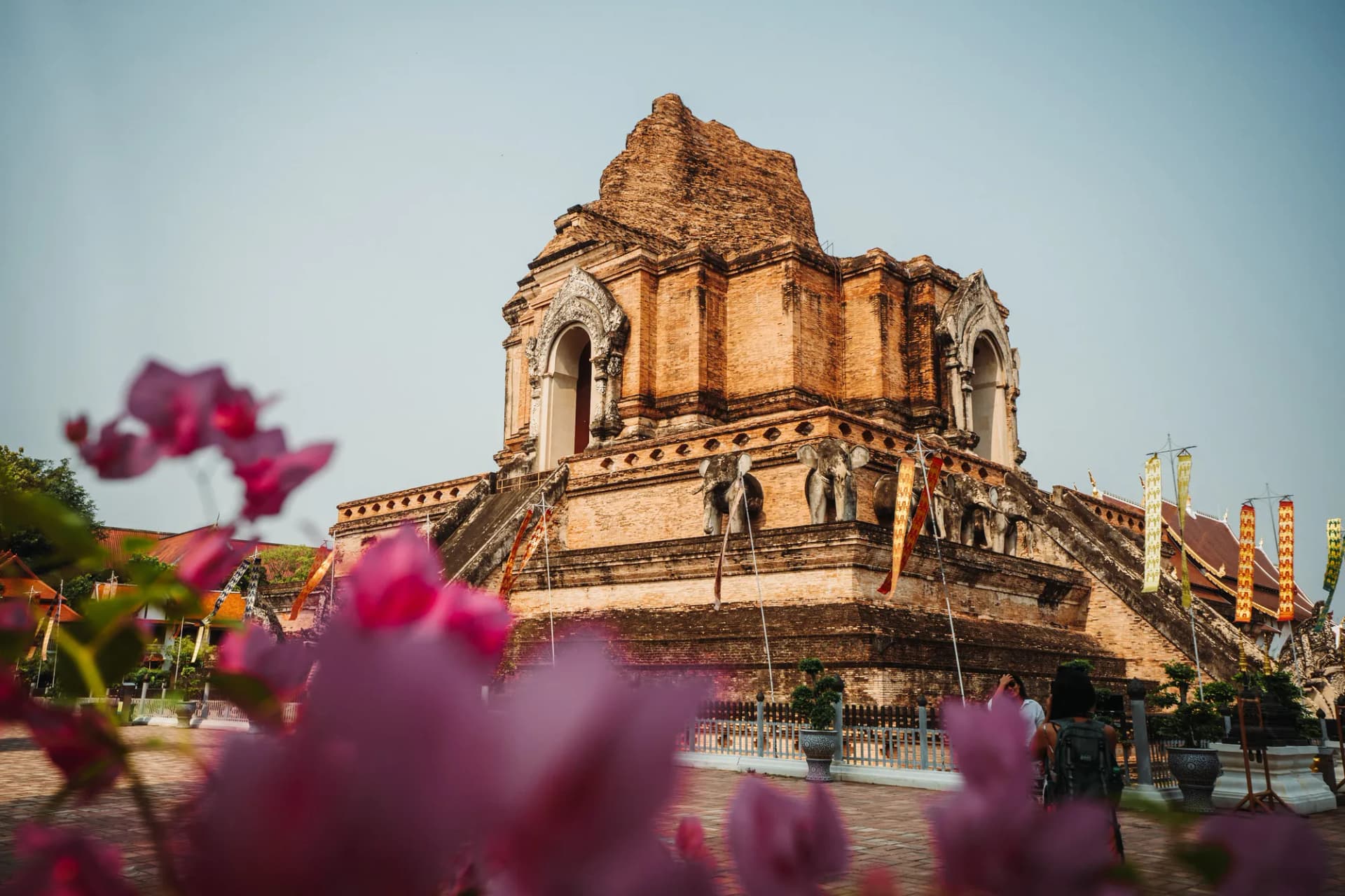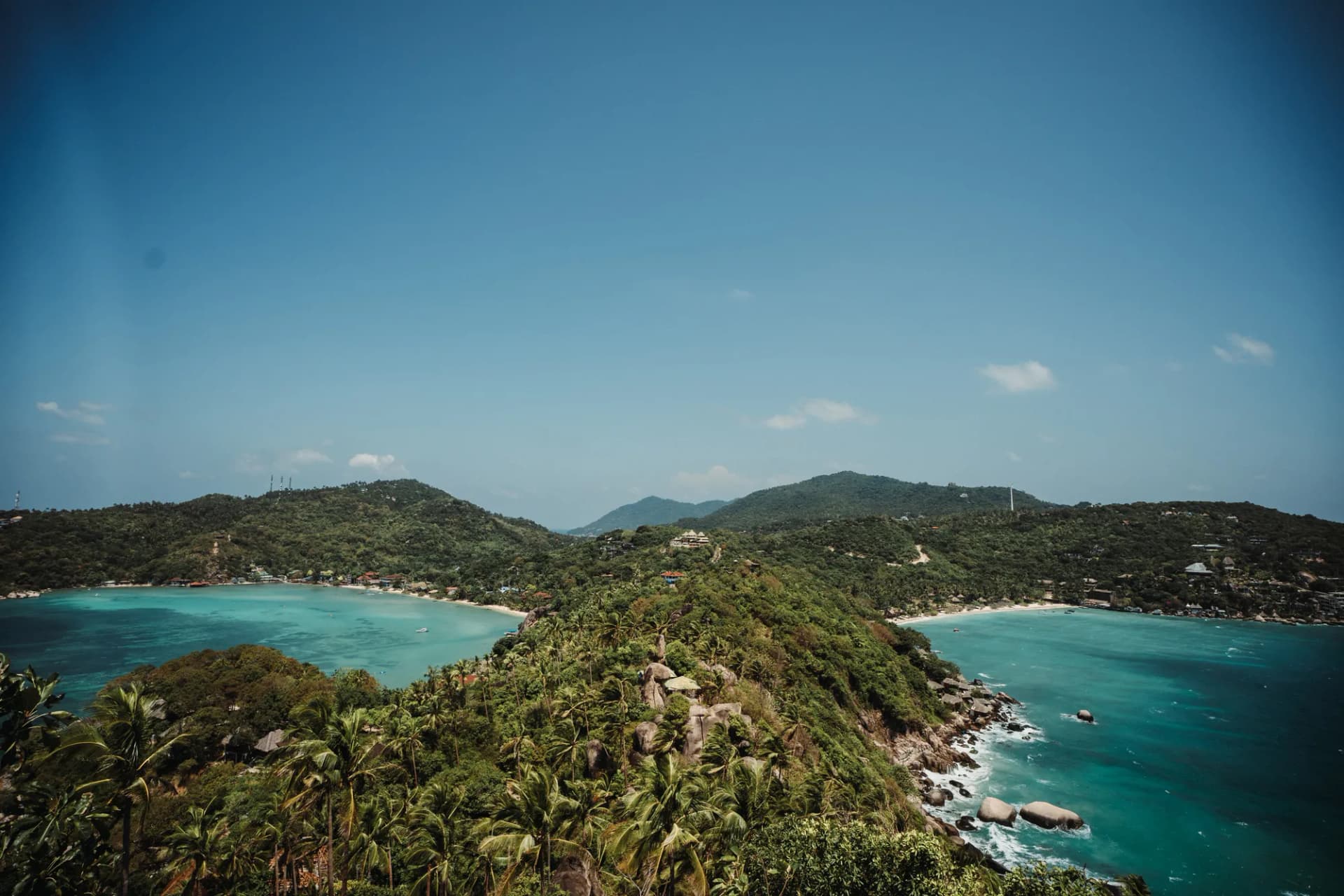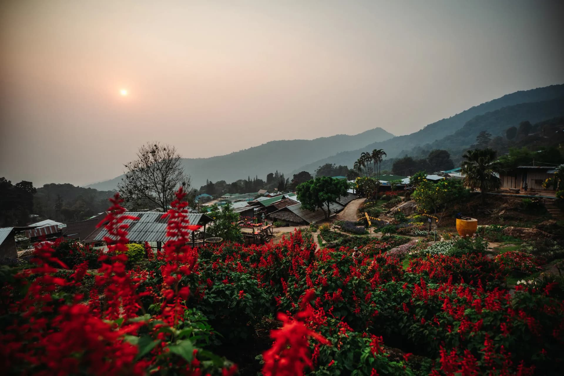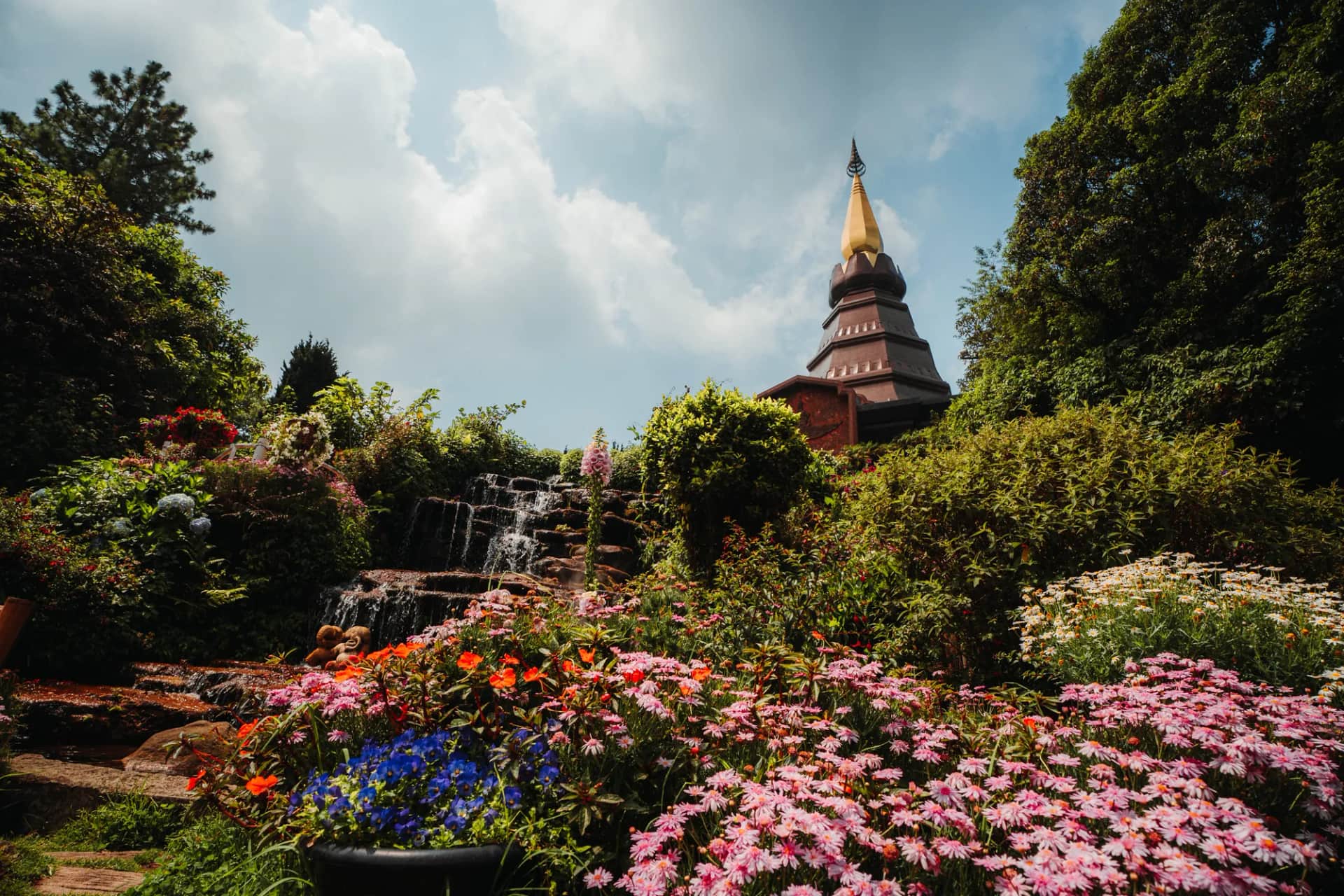

On 14 April 2024, I headed up Doi Inthanon, the roof of Thailand, at 2,565 metres. Down below, Chiang Mai had been wrapped in burning-season smoke for weeks. Up top, my photos show blue sky above the two royal chedis and a forest of mosses and ferns in an almost unreal shade of green.
Doi Inthanon makes a very good day trip from Chiang Mai, as long as you set off early and know in which order to string the stops together: the summit and its cloud forest, the two chedis and their gardens, the Wachirathan, Sirithan, Mae Klang and Mae Ya waterfalls, the Kew Mae Pan ridge trail, the Hmong and Karen villages. The 48km road climbing from Chom Thong is long, and every detour costs you time.
This guide brings together what my photos show and everything I checked in October 2026: fees, opening hours, the Kew Mae Pan season, transport and what to pack.
Doi Inthanon in brief: the roof of Thailand
Doi Inthanon is Thailand's highest peak, at the southern end of the Thanon Thong Chai range, in Chom Thong district. The mountain was once called Doi Luang Ang Ka, after a pond where crows used to gather. Today it bears the name of Chao Inthawichayanon, a ruler of Chiang Mai in the late 19th century who set out to protect these forests. His ashes rest in a small stupa at the summit.
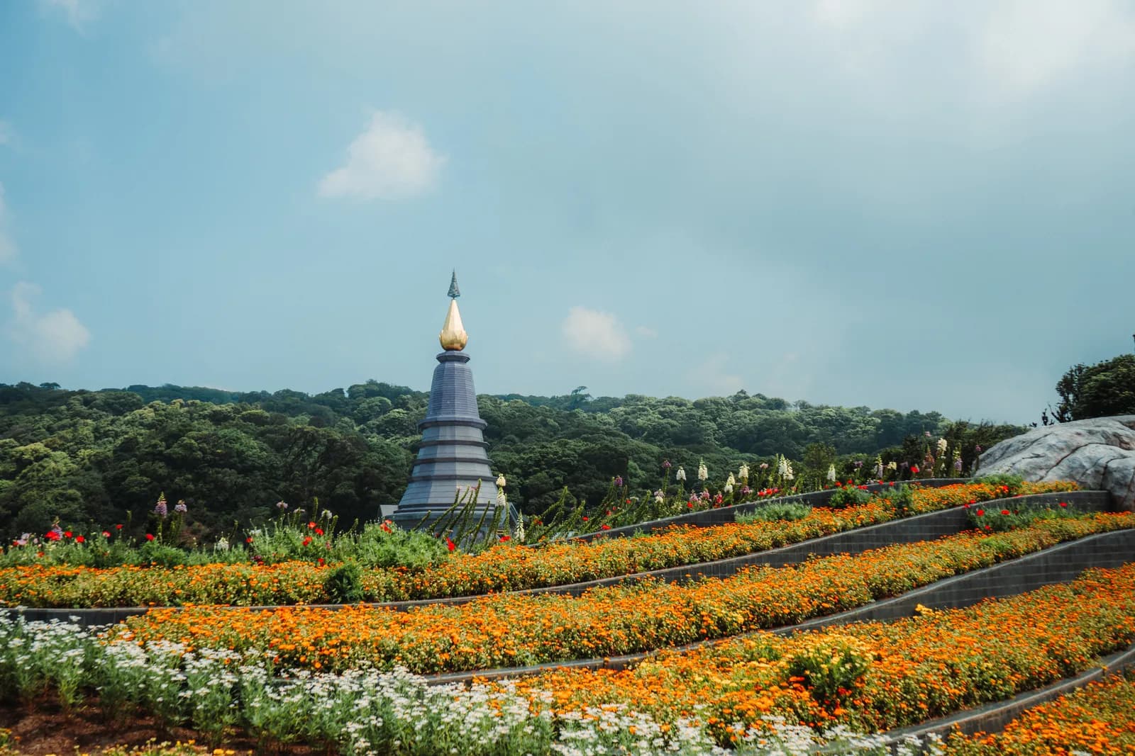
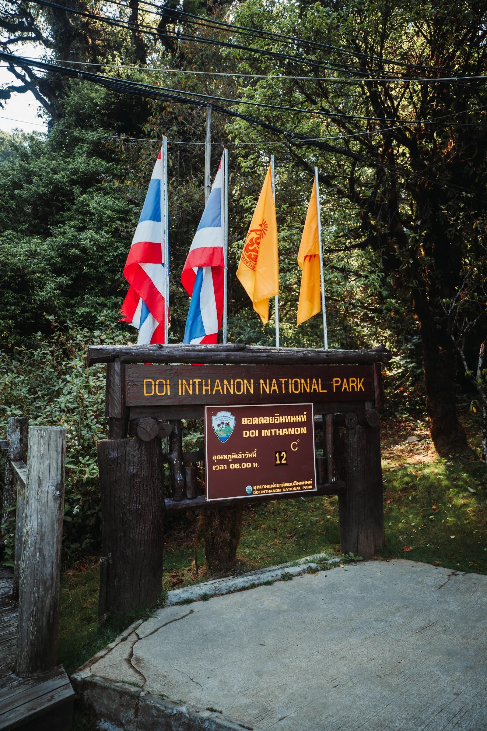
The national park was created on 2 October 1972, the sixth in the country. It covers 482km² between 800 and 2,565 metres, and around 4,500 Hmong and Karen people live in its villages. It is also one of the best birdwatching sites in South-East Asia, with several hundred species recorded.
It is also one of the most visited parks in the north: nearly 854,000 visitors in 2024, and more than 9,000 on 1 January 2026 alone. Hence my main tip: go up early, and avoid weekends and public holidays.
How to get to Doi Inthanon from Chiang Mai
The route is simple: Route 108 south-west to Chom Thong (about 58km), then Route 1009, which climbs to the summit over about 48km. Sights are signposted by their kilometre marker on the 1009: Mae Klang waterfall around km 8, Wachirathan around km 21, the park headquarters and Ban Khun Klang village around km 31, the chedis and Kew Mae Pan around km 41 and 42, and the summit at km 48.
By car
This is the most comfortable option if there are several of you. The road is paved and in good condition, but very winding in its upper section, with steep gradients. Use engine braking on the way down. The car costs 30 baht at the gate, on top of the tickets. An International Driving Permit is compulsory to drive in Thailand.
DiscoverCars
Car rental comparison in 150+ countries
Compare prices from Hertz, Avis, Sixt and local providers. All fees included, free cancellation. Rated 4.6/5 on Trustpilot.


By scooter
Allow 1.5 to 2 hours each way on a scooter of at least 150cc, rented for 250 to 450 baht a day, plus 250 to 300 baht of fuel for 200km. I only recommend it to experienced riders: a long descent, tight bends and cold mornings at altitude. Read my tips for travelling safely before you set off.
By songthaew
It is possible, but limited. Yellow songthaews run from Chiang Mai Gate (Pratu Chiang Mai) to Chom Thong, where another songthaew goes up to the park headquarters. They leave when full: allow two to three hours. No public transport serves the summit, the chedis or Kew Mae Pan. Best kept for those staying overnight in the park.
By organised tour or with a driver
A shared minibus tour usually costs 1,200 to 1,800 baht per person, with hotel pick-up and often lunch included. A typical programme: summit, chedis, Wachirathan, a market, sometimes Kew Mae Pan or Pha Dok Siew. A private driver costs from around 3,200 baht for the day, more often 3,000 to 4,500 baht: good value for four, and you set the pace.
| Option | Time one way | Indicative price | Best for |
|---|---|---|---|
| Hire car | 2 hours | Rental + 30 baht park vehicle fee | Families, groups, confident drivers |
| Scooter | 1.5 to 2 hours | 250 to 450 baht/day + 250 to 300 baht of fuel | Experienced riders |
| Public songthaews | 2 to 3 hours (to the HQ) | A few dozen to 150 baht per leg, to be checked | Budget travellers staying overnight |
| Minibus tour | 2 hours | 1,200 to 1,800 baht/person | Solo travellers, non-drivers |
| Private driver | 2 hours | 3,000 to 4,500 baht/vehicle | Groups of 3 or 4, photographers |
My recommended hour-by-hour itinerary
The idea: drive straight up to the summit, then stop on the way down. You arrive ahead of the minibuses and save the waterfalls for the afternoon. Judging by the order of my photos, that is what I did: the summit first, then the chedis, Wachirathan last.
| Time | Stop | Tip |
|---|---|---|
| 6.00am | Leave Chiang Mai | Breakfast to go, fleece in the bag |
| 8.00am | Park entrance, Route 1009 | Buy entry and vehicle tickets at the barrier |
| 8.30am | Summit, stupa and Ang Ka trail | 45 minutes is enough |
| 9.30am | Kew Mae Pan (November to end of May) | 2 to 3 hours with the compulsory guide |
| 12.00pm | The two royal chedis and their gardens | 1 to 1.5 hours |
| 1.30pm | Lunch near Ban Khun Klang, Hmong market | Fruit, strawberries in season, simple dishes |
| 2.30pm | Mae Klang Luang: rice terraces and Karen coffee | 1 hour, or Mae Ya instead |
| 4.00pm | Sirithan and Wachirathan waterfalls | 45 minutes for both |
| 4.45pm | Mae Klang waterfall (if time allows) | 20 minutes, near the exit |
| 6.30pm | Back in Chiang Mai | Avoid riding down in the dark |
From June to October, swap Kew Mae Pan for Mae Ya or the Pha Dok Siew trail. For sunrise over the sea of cloud, stay overnight (park bungalows or Chom Thong).
The summit and the Ang Ka cloud forest
The summit itself has no view: it is covered in forest, and a military radar station occupies the highest point. What people come for is the small shrine dedicated to Chao Inthawichayanon, surrounded by elephant statues and offerings, and the "highest point in Thailand" sign, where Thai families queue for a photo.
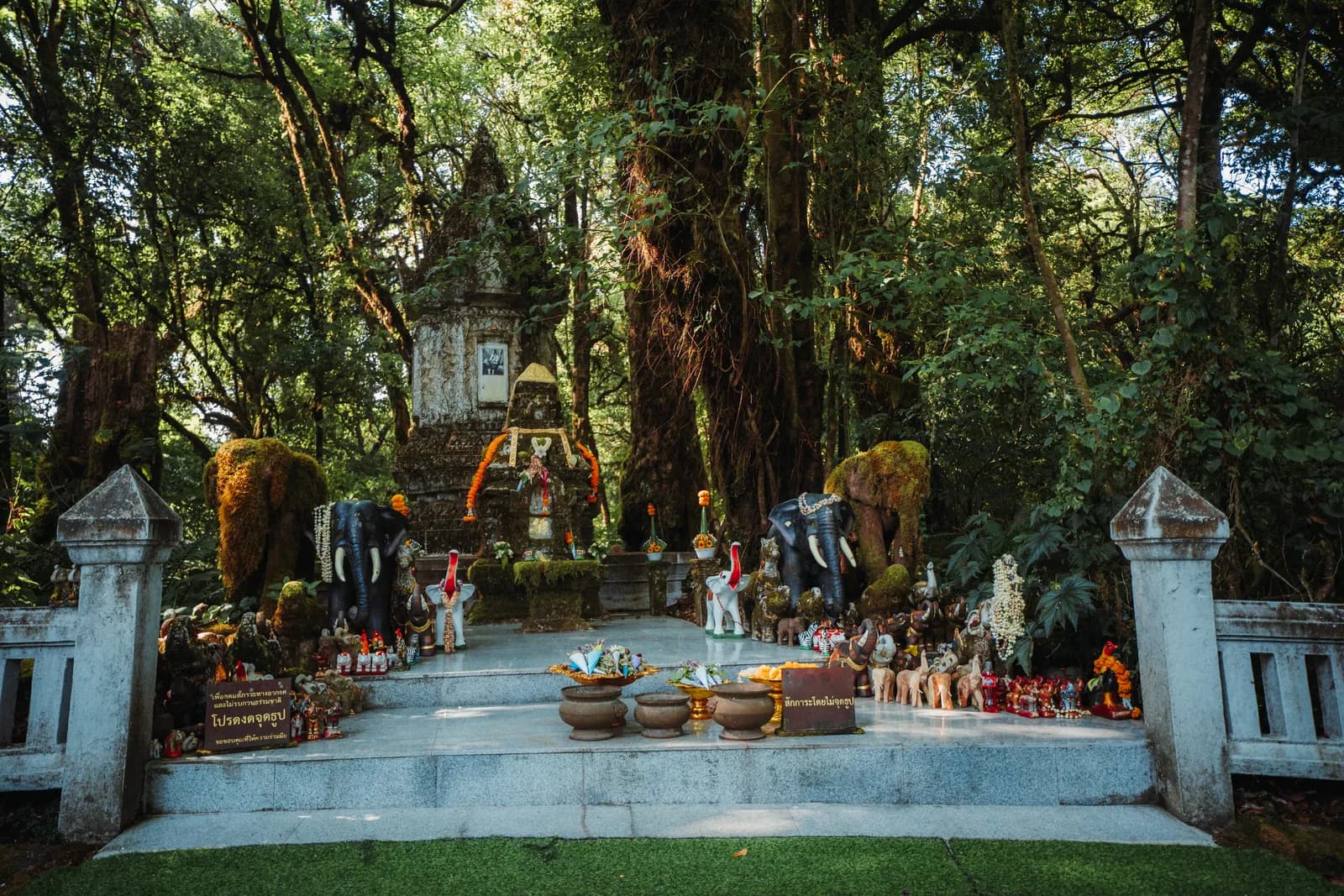
In my photos, the shrine is almost empty, shaded by tall trees draped in epiphytes, with garlands of orange flowers and elephants of every size left as offerings. It is a place of worship: keep your voice down.
The Ang Ka trail
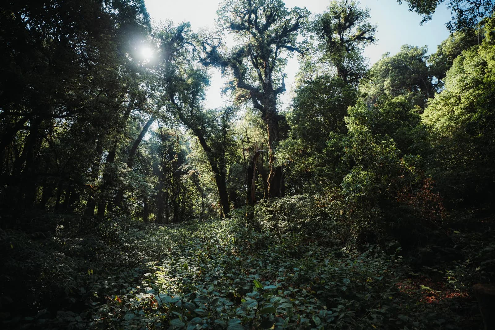
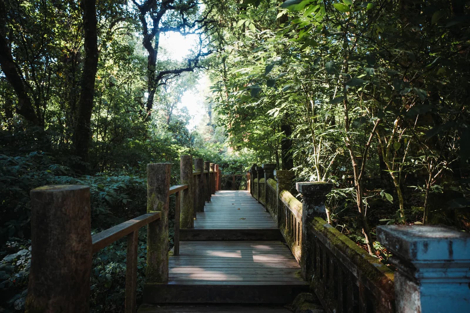
A stone's throw from the summit car park, the Ang Ka trail is a loop of about 360 metres on a wooden boardwalk, done in 20 to 30 minutes. It is the highlight of the summit. You walk through cloud forest and a small high-altitude bog: sphagnum moss, tree ferns, trunks completely wrapped in moss, and red rhododendrons that flower from December to February.
Photos : Pierre Bouyer
The boardwalk is flat and accessible to everyone. My April photos show sunlight breaking through the branches and a very green forest, while the plains below were dry. Stay on the boards: the ground is fragile.
The two royal chedis and their gardens
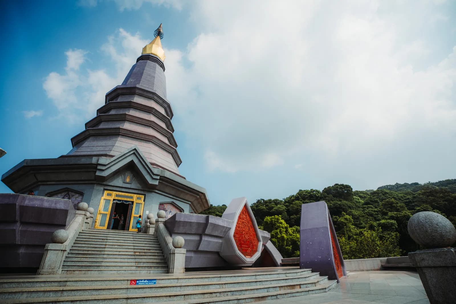
Around km 41, on a ridge at just over 2,000 metres, stand the chedis of Phra Mahathat Naphamethinidon and Phra Mahathat Naphaphonphumisiri. They are not ancient temples: the Royal Thai Air Force built them for the 60th birthdays of King Bhumibol (1987) and Queen Sirikit (1992). They have become the symbol of Doi Inthanon.
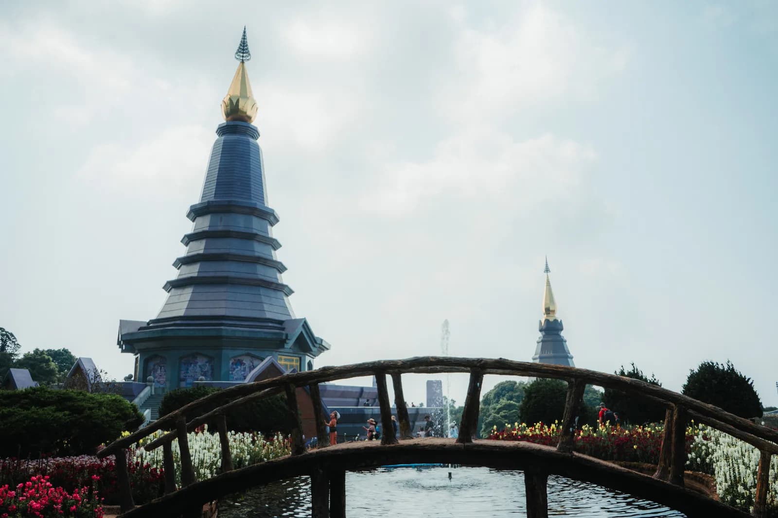
Access to the two chedis costs 100 baht per person, on top of park entry. They open early in the morning and close in the late afternoon (roughly 6am to 5.30pm, to be checked on site). Staircases lead up to each one, alongside covered escalators.
Naphamethinidon, the King's chedi
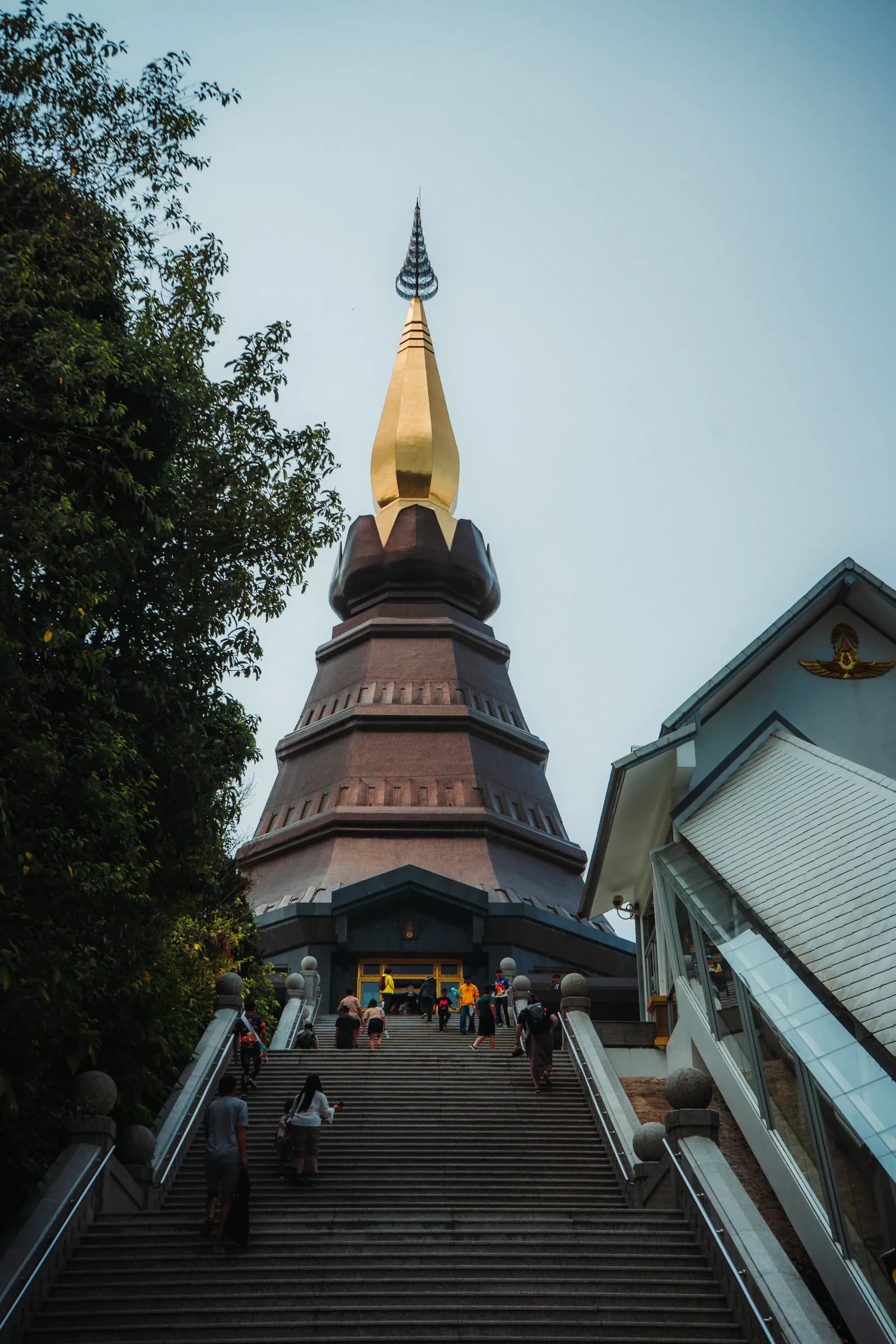
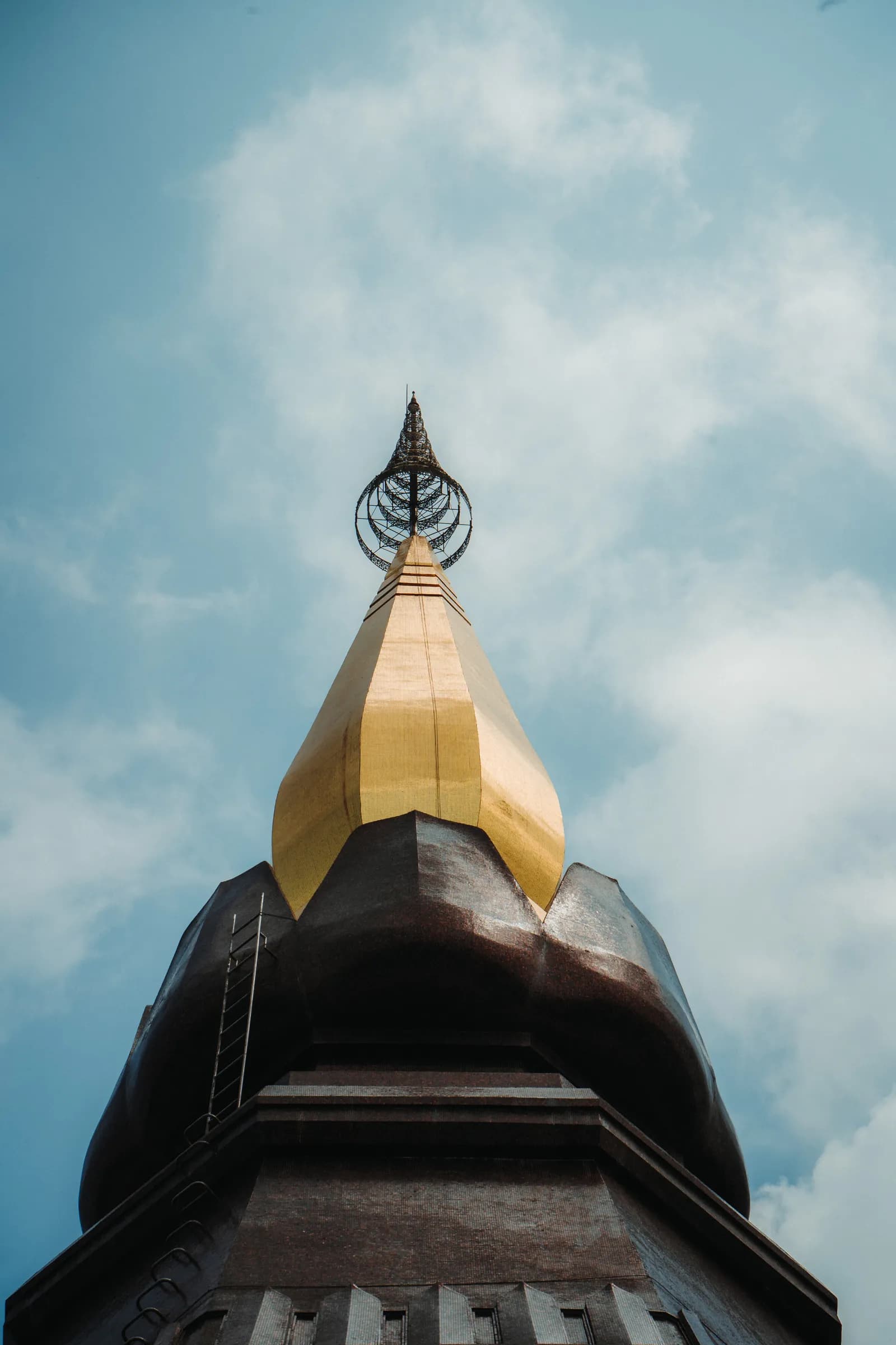
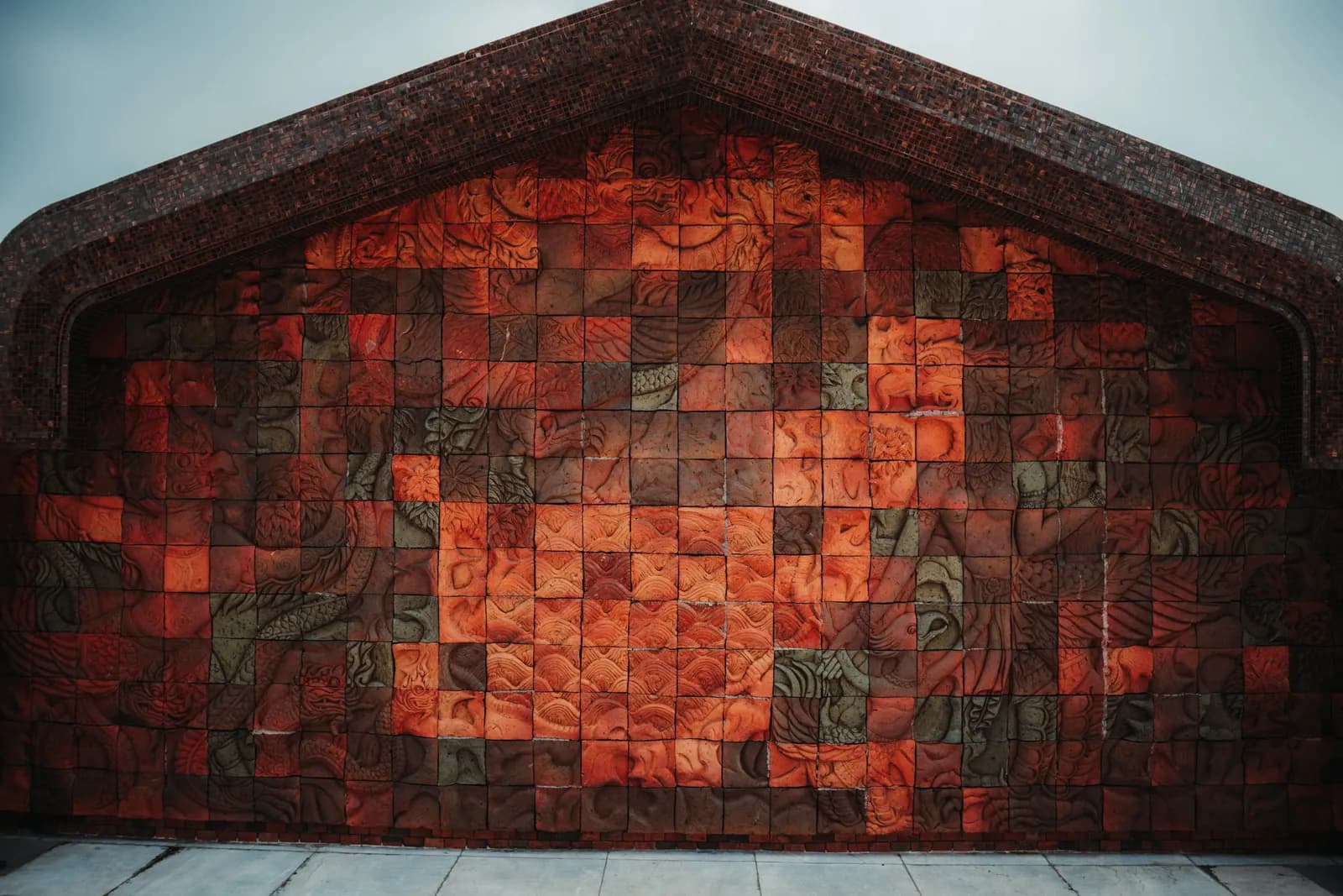
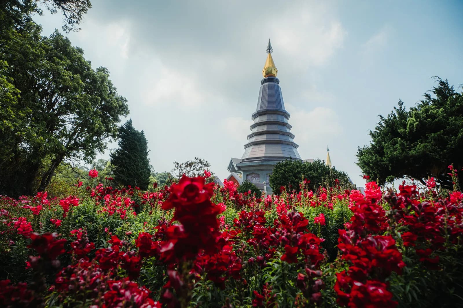
The King's chedi is the darker of the two, brown and burgundy, topped with a golden spire, with tiers reminiscent of a pagoda. My photos show the long front staircase, flanked by a covered walkway, and the spire standing out against a blue sky. Take a close look at the red ceramic panels carved in relief: they are very graphic.
Photos : Pierre Bouyer
Naphaphonphumisiri, the Queen's chedi
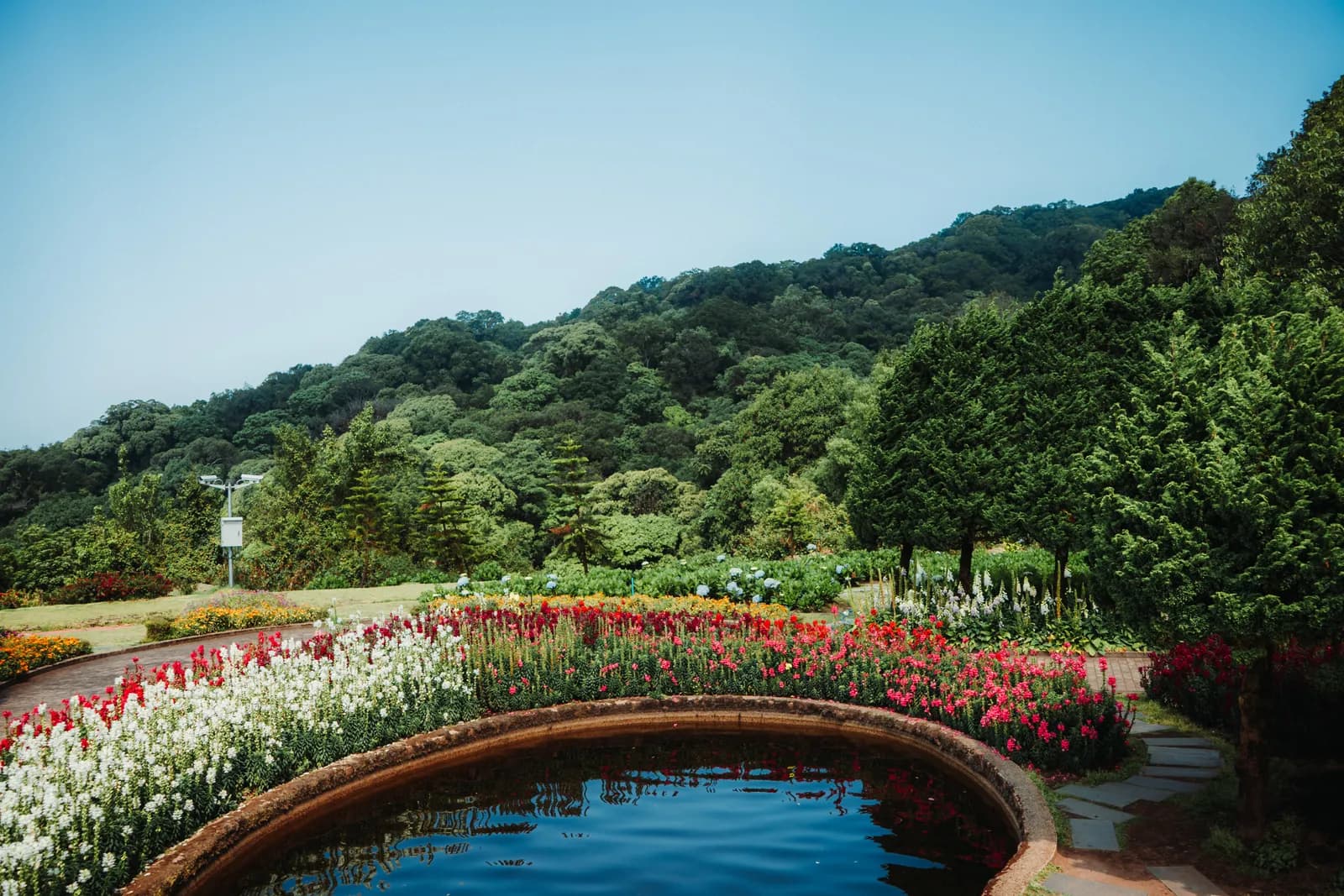
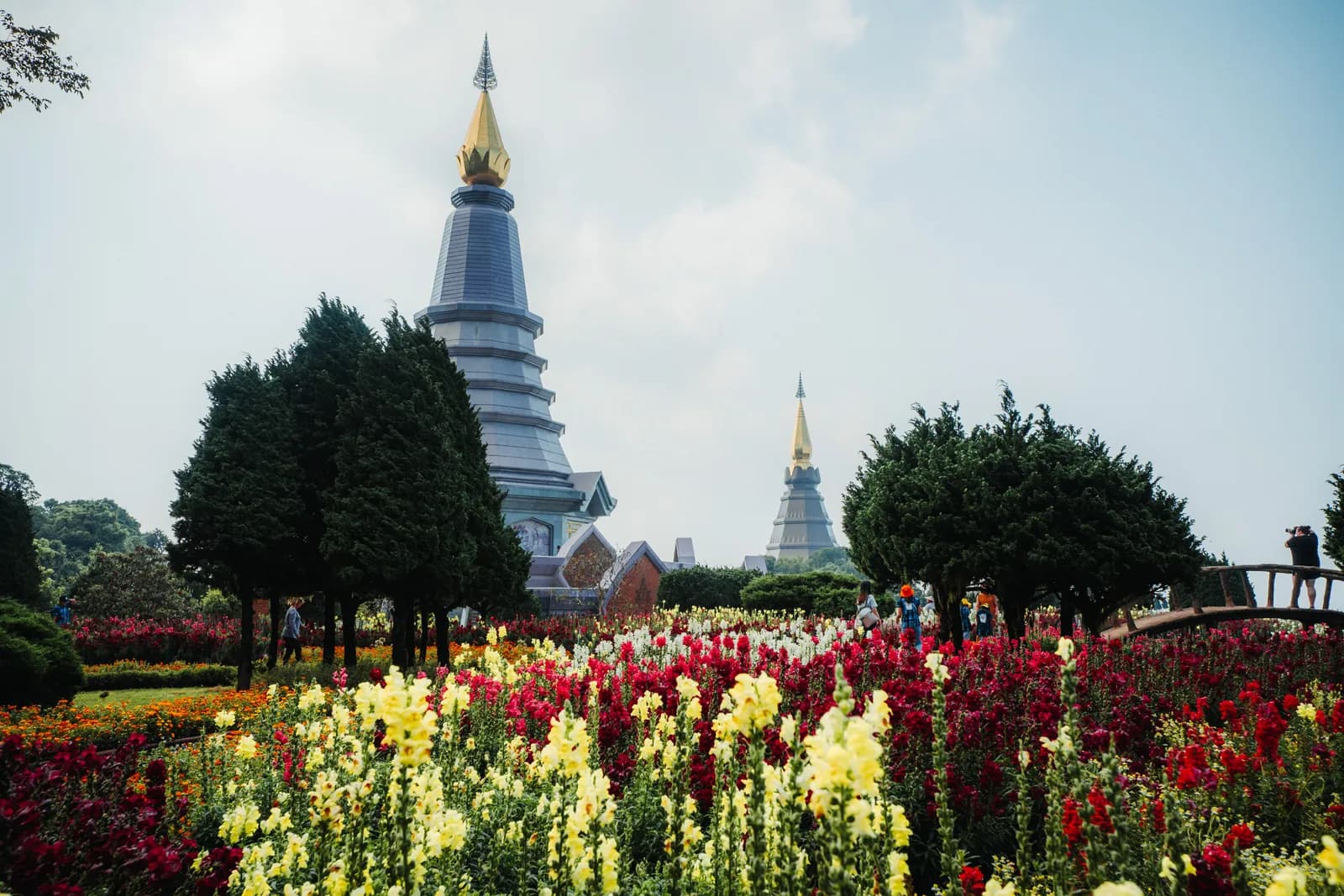
The Queen's chedi is paler, lilac-grey and more slender, with petal-shaped ornaments around its base. It is the more photogenic of the two, because it towers over terraced gardens. In April, when I was there, yellow marigolds, red and white snapdragons, celosias and foxgloves framed it.
Inside the chedis
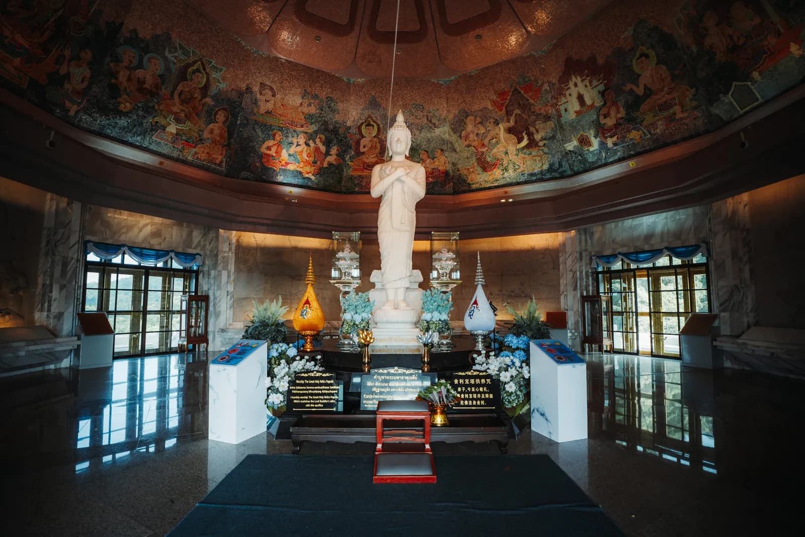
Do go inside. The chedi I photographed houses a standing white Buddha beneath a dome painted with scenes from the life of the Buddha, with a polished marble floor and large windows looking out over the mountain. Shoes come off at the entrance, and shoulders and knees must be covered.
Photos : Pierre Bouyer
The gardens and the view
Between the two chedis lie carefully tended gardens: curved ponds, an arched wooden bridge, a fountain, clipped shrubs and conifers. On the King's chedi side, an artificial waterfall tumbles between beds of pink daisies and blue lobelias. On a clear day, the view stretches across the park's wooded ridges.
Photos : Pierre Bouyer
This is where the crowds gather, especially between 10am and 2pm: come early in the morning or around 4pm.
The waterfalls of Doi Inthanon
Four waterfalls are worth stopping for, two of them right by the main road. Their flow is impressive from August to November, more modest in March and April.
Mae Klang, the lowest
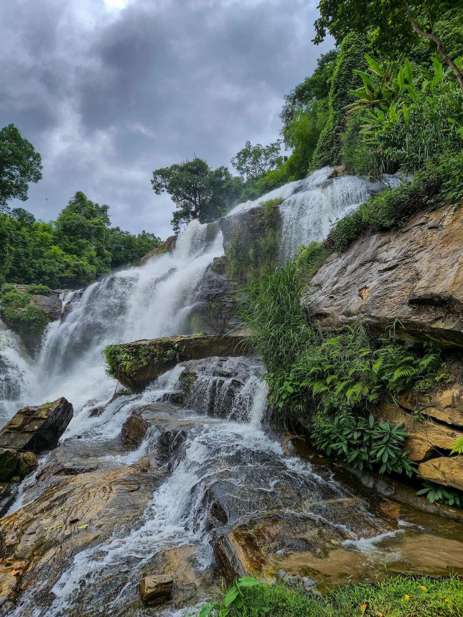
Mae Klang, around km 8 near the first checkpoint, spreads its wide falls over granite slabs, with laid-out paths and food stalls. It is the most accessible and the busiest at weekends: visit it on the way back.
Wachirathan, the most spectacular
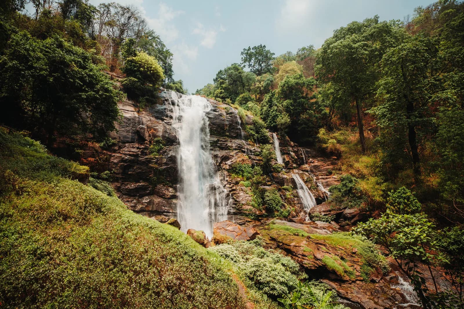
Wachirathan, around km 21, is the one everyone photographs: a powerful fall over a dark granite cliff, whose spray soaks the viewpoint in the rainy season. In my mid-April photos, in the middle of the dry season, the flow was still decent and the banks were green and russet. The steps down to the lower viewpoint are slippery.
Sirithan, a few minutes away
Sirithan is a little higher up the same road, a hundred metres' walk from the car park: a two-tiered fall of about 50 metres at the bottom of a wooded valley. I did not photograph it, but it is the easiest addition to Wachirathan, with fewer people.
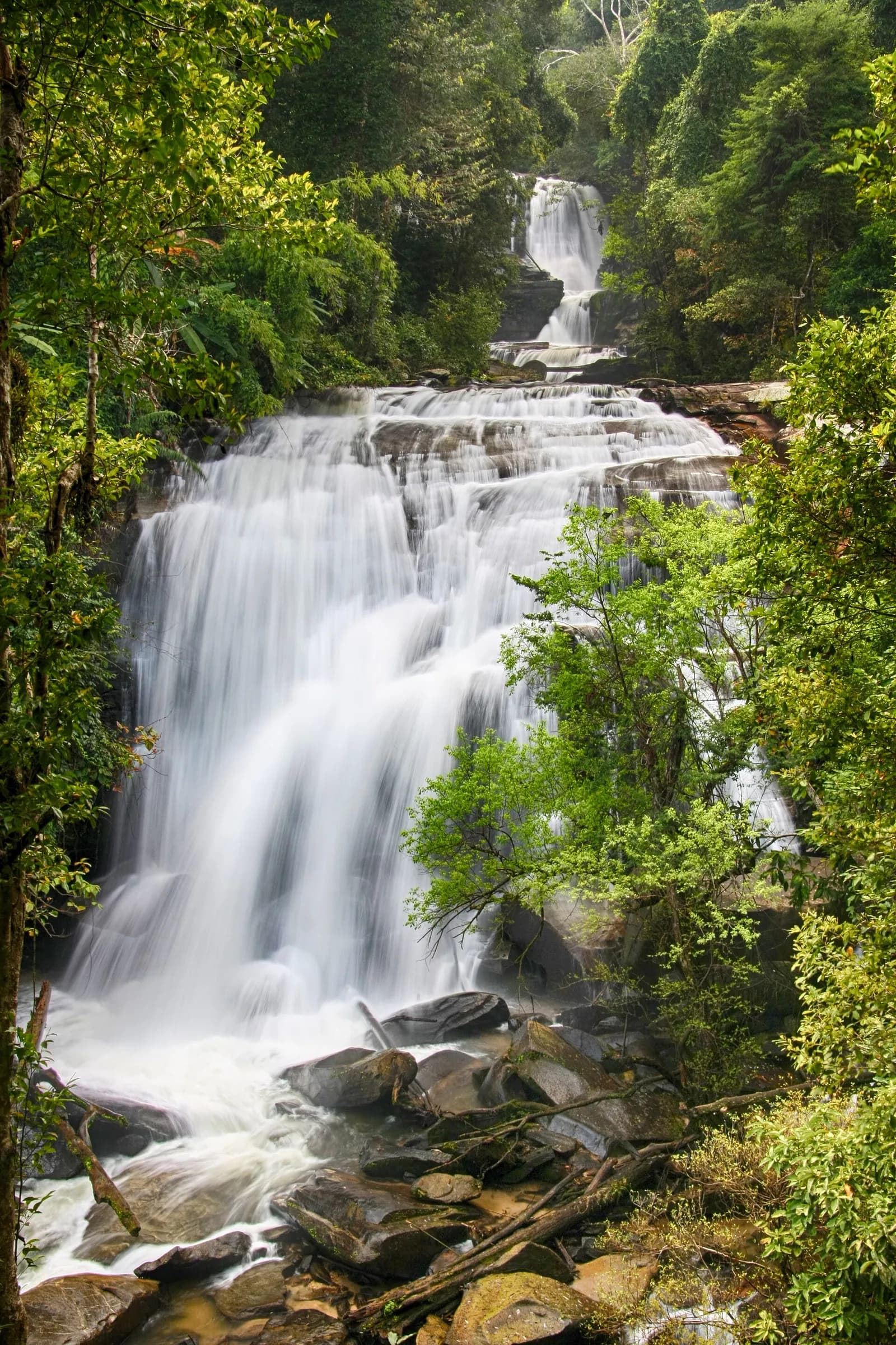
Mae Ya, the detour that pays off
Mae Ya is not on the summit road: it lies to the south-west, along a side road, about 14 to 17km from the main checkpoint. It is a huge waterfall cascading down tiers of rock, often described as the most beautiful in the park (its height varies a lot depending on the source). Your day ticket is valid at its checkpoint. Allow a 1.5 to 2-hour detour. I did not see it: it is the first thing I would add if I went back.
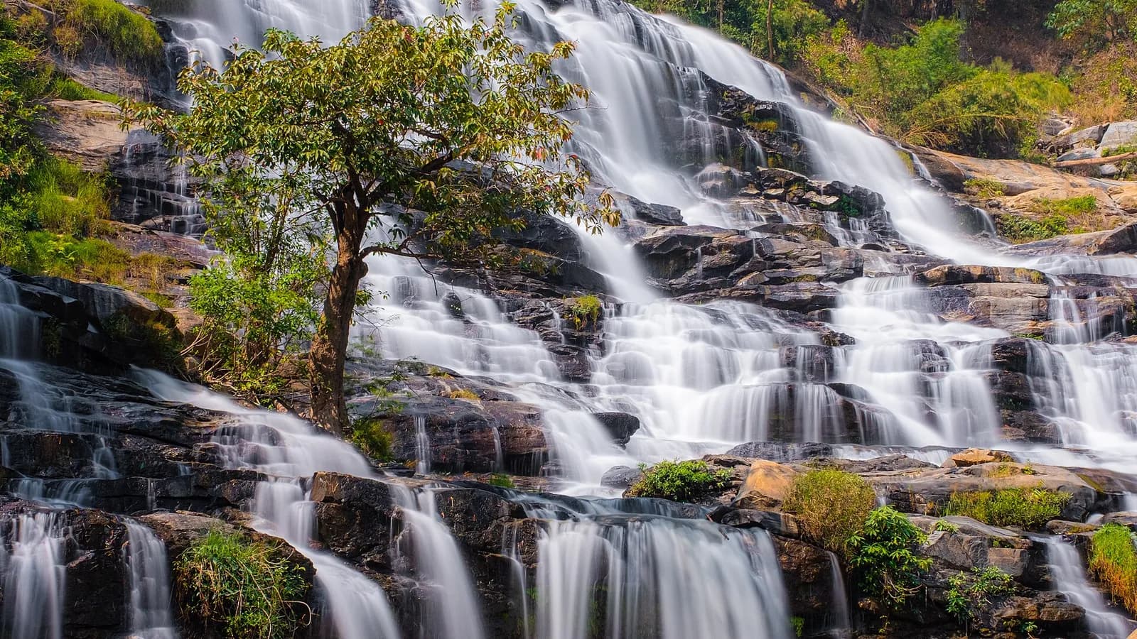
The Kew Mae Pan trail, a ridge above the clouds
Kew Mae Pan is the best walk of the day, and the only real view on Doi Inthanon. The trail starts around km 42, just past the chedis: a loop of 2.5 to 3.2km depending on the source, taking two to three hours, from mossy forest to a grassy ridge on the edge of a cliff. Early in the morning, from November to January, the valley is often lost in a sea of cloud.
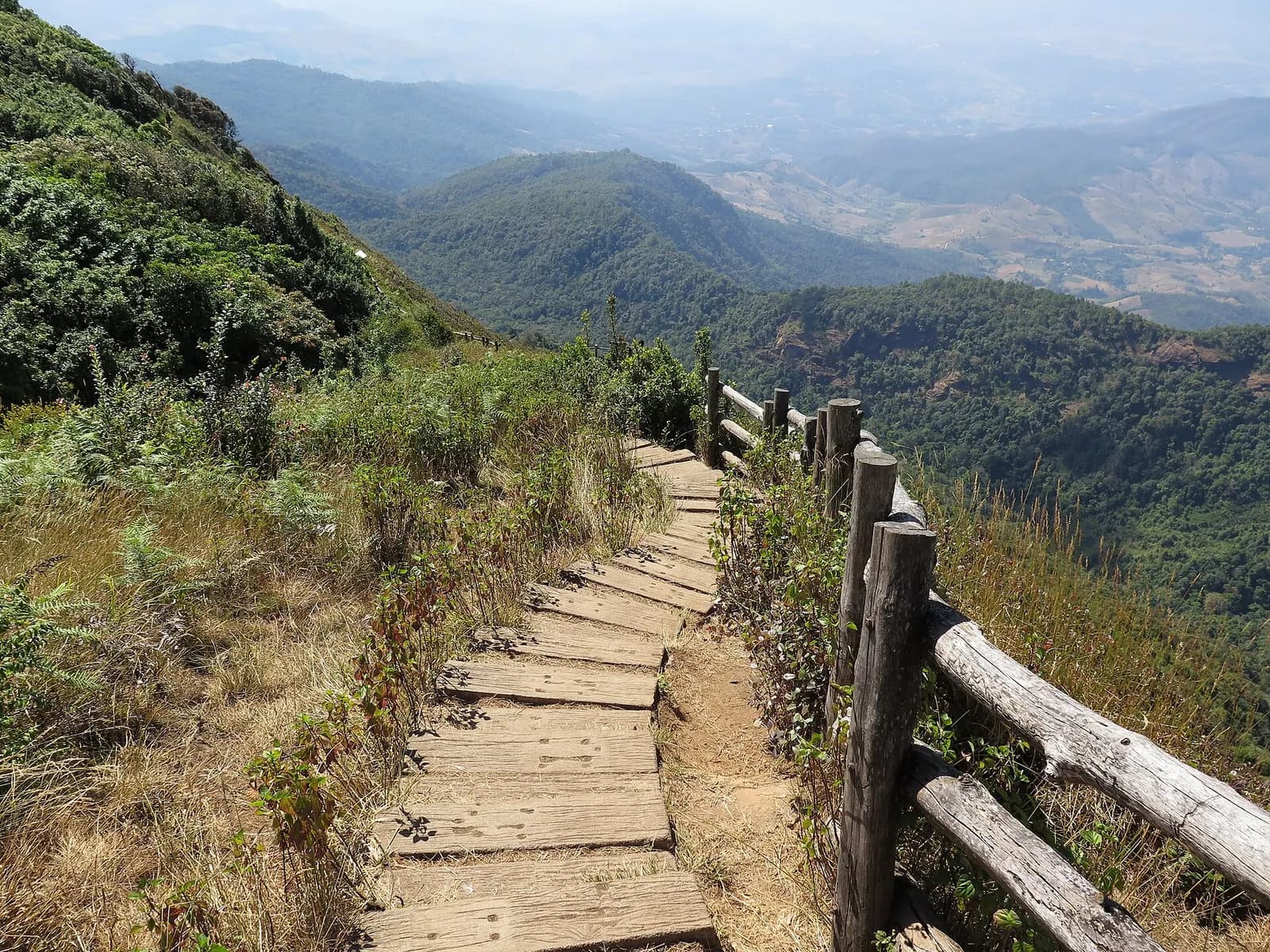
I did not walk it. Here are the rules as checked in October 2026:
- Season: from early November to the end of May. It closes every year from June to October, during the monsoon. It reopened on 2 November 2025, and 2026 should follow the same calendar.
- Compulsory guide: local guides, often Hmong, wait at the start (328 were licensed for the 2025-2026 season). Allow around 200 baht per group (220 according to some sources).
- Hours: starts from around 6am to 4pm. For the sea of cloud, be at the trailhead at 6am.
- Difficulty: easy to moderate, with steps and some sloping sections. Very busy from December to February, especially at weekends.
Hmong and Karen villages, the market and the rice terraces of Mae Klang Luang
The park's Hmong and Karen villages grow strawberries, vegetables, coffee and flowers, often with support from the royal projects that replaced opium with other crops.
The Hmong market
Near the Hmong village of Ban Khun Klang, not far from the park headquarters, stalls sell strawberries and cape gooseberries in season, persimmons, oranges, avocados and squash, as well as dried fruit. A good stop to buy fruit, and the money goes straight to the families. It is a farmers' market, not a handicraft one.
Mae Klang Luang, rice terraces and Karen coffee
Ban Mae Klang Luang is a Karen (S'gaw) village known for its terraced rice paddies and its Arabica coffee grown in the shade of the forest, which several families roast and serve in small cafés above the paddies. The terraces are green from August to October, then golden in late October and November, before the harvest. In the dry season, they are harvested and brown, but the coffee alone justifies the stop.
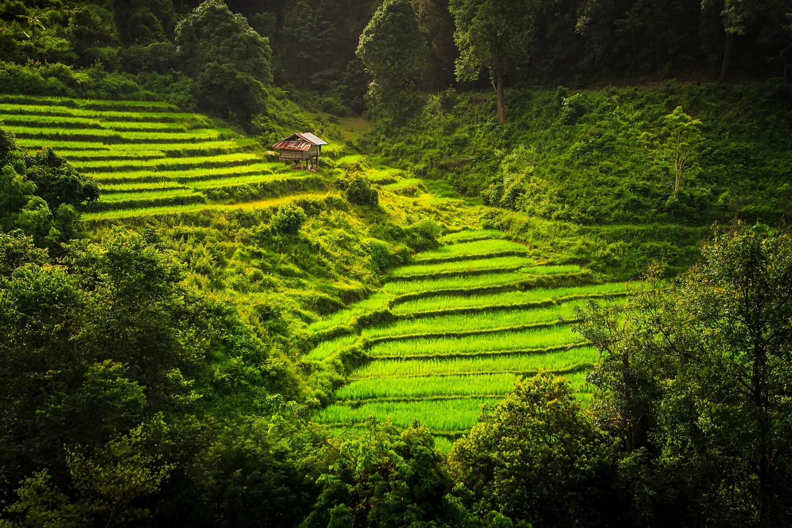
It is also the end point of the Pha Dok Siew trail: about 2.6km (1.5 hours) along a river and waterfalls, with a compulsory Karen guide (around 220 baht per group of up to ten, to be confirmed). The best alternative to Kew Mae Pan in the rainy season. I did not go to Mae Klang Luang: this information comes from my research.
Fees, opening hours and budget
Tickets are sold at the checkpoint on Route 1009, preferably in cash. The ticket is valid for the day at every site in the park, Mae Ya included.
| Item | Price | Note |
|---|---|---|
| Park entry, foreign adult | 300 baht | 150 baht for a child aged 3 to 14 |
| Car / motorbike | 30 / 20 baht | Paid at the barrier |
| Two royal chedis | 100 baht | Per person, on top of park entry |
| Kew Mae Pan guide | Around 200 baht | Per group, November to end of May |
| Pha Dok Siew guide | Around 220 baht | Per group of up to ten |
| Minibus tour | 1,200 to 1,800 baht | Per person, entry often included |
| Private driver | 3,000 to 4,500 baht | Per vehicle per day |
| Scooter + fuel | 500 to 750 baht | One day's rental and 200km |
For two people on a scooter, with the chedis and Kew Mae Pan, allow about 1,500 to 1,800 baht in total, excluding food. The park is open from 5.30am to 6.30pm, the visitor centre from 8am to 4pm.
Weather, best season and what to pack
It really is cold at the top
In winter, the average temperature at the summit is around 6°C. On 2 January 2026, the park recorded 3°C at the summit, 4°C at Kew Mae Pan and frost on the ground, for the 25th time that season; the official record is minus 5°C, in December 2017. Thais come up precisely to see the frost, hence the New Year crowds.
When to go
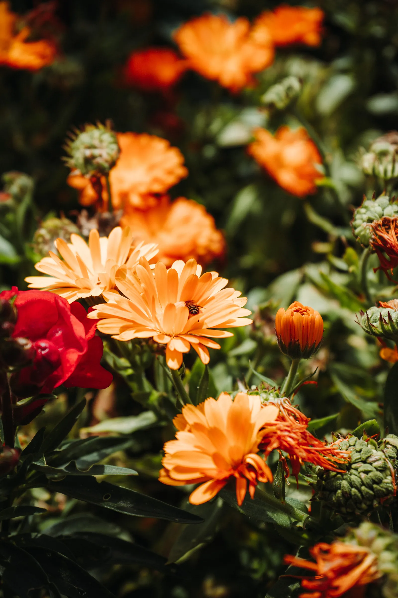
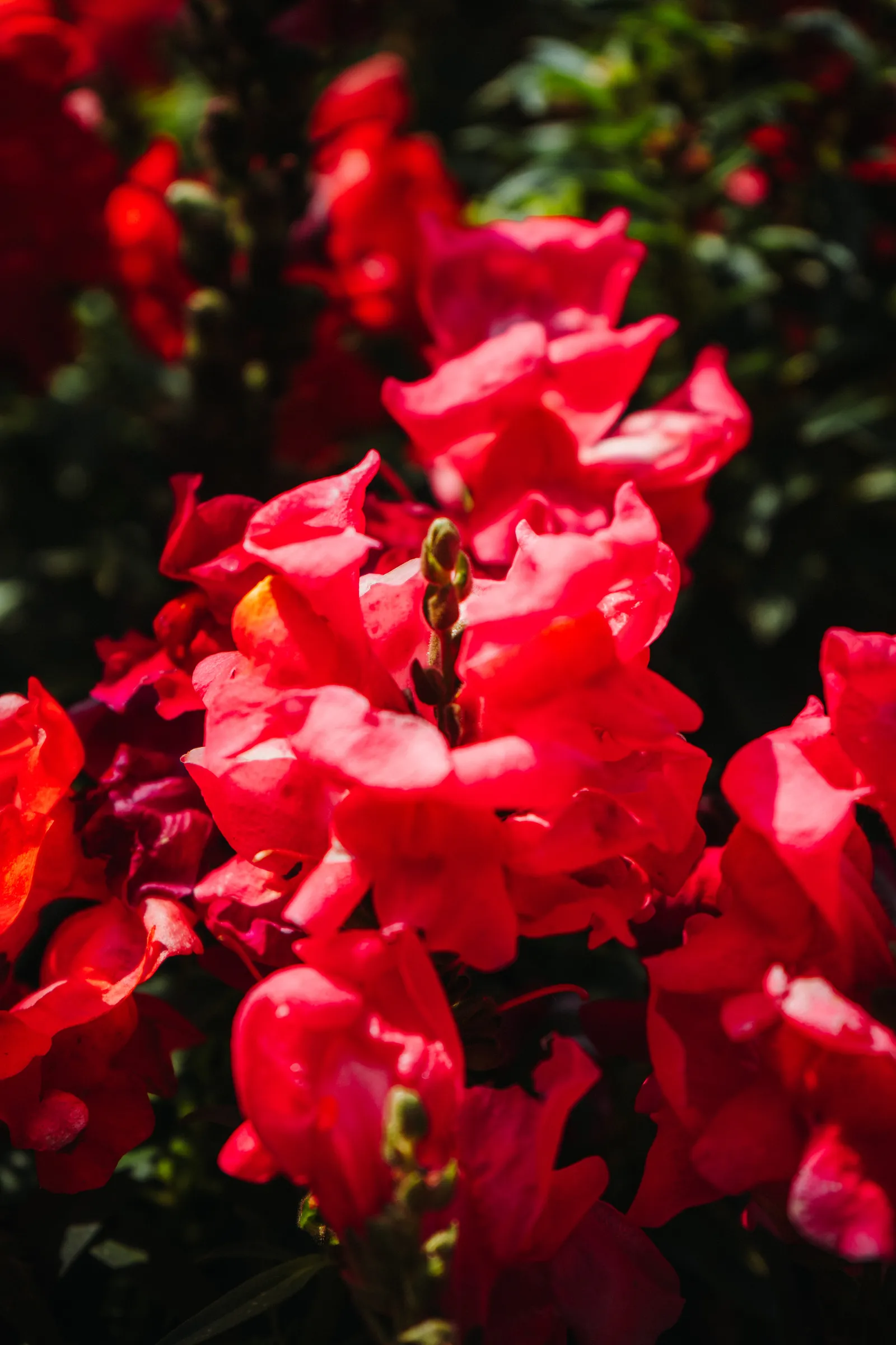
Photos : Pierre Bouyer
- November to February: the best period. Dry, clear air, seas of cloud at sunrise, Kew Mae Pan open, rhododendrons flowering from December to February. The downside: big crowds at weekends and during holidays.
- March and April: hot season and burning season. It is pleasant at altitude and the chedi gardens are in bloom, but smoke can block the view. See the next section.
- May to October: rainy season. Waterfalls at their peak, lush forest, green paddies at Mae Klang Luang, but frequent fog at the summit, slippery roads and Kew Mae Pan closed from June to October.
What to pack
- A fleece or light down jacket, even in April: it is much cooler than in town.
- A waterproof windbreaker, for the Kew Mae Pan ridge and the spray at Wachirathan.
- Closed shoes with good grip: wet steps at the waterfalls, earth and roots on the trails.
- Clothing that covers shoulders and knees for the chedis, and socks, as shoes come off.
- Cash in small notes for entry, the guide and the market.
- Sunscreen and sunglasses: the sun is strong at altitude, even when it feels cool.
- A power bank and a travel eSIM for navigation: coverage is fine on the main road, patchier in the valleys.
My photos were taken with my Sony A7 III, mostly with a wide-angle lens: ideal for the chedis and the Ang Ka forest.
Burning season: what I saw on 14 April 2024
Doi Inthanon does not escape the smoke. The burning season affects the whole north from January or February to April, peaking in March, and fires also burn in the forests around the park. Studies show that the smoke layer often reaches 2 to 3km in altitude: at 2,565 metres, the summit is therefore regularly inside it, not above it. It is all explained in my article on Chiang Mai and the burning season.
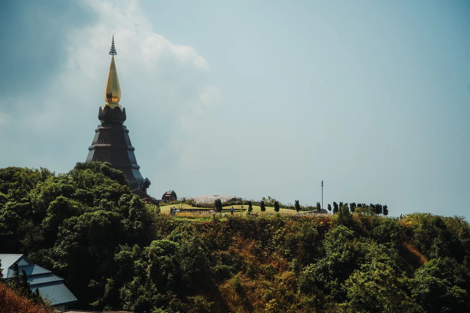
Here is what my photos from 14 April 2024 show. In Chiang Mai, on the previous days, the sky was milky white. On Doi Inthanon that day, the sky was blue above the chedis and the Ang Ka forest was bathed in sunshine. But towards the horizon, from the chedi ridge, the distant mountains are lost in a grey veil: clear sky overhead, no long-distance view.
This is a single day's observation, not a rule: on other days, the summit can be in the smoke. In March or April, Doi Inthanon is still a good escape for the cool air and the gardens, but do not count on a panorama. Check Air4Thai or IQAir the day before, and go up early. In 2026, the forest areas of nine northern parks, including Doi Inthanon, were closed from 1 February to 30 April, but the tourist sites stayed open.
Frequently asked questions
300 baht for a foreign adult and 150 baht for a child, plus 30 baht for a car or 20 baht for a motorbike. Visiting the two royal chedis costs another 100 baht per person, and the Kew Mae Pan trail guide around 200 baht per group.
Allow about two hours for roughly 100km between the old city and the summit, via Route 108 to Chom Thong and then Route 1009, which climbs for almost 48km. By public transport (two songthaews), it takes two to three hours just to reach the park headquarters.
No. It closes every year during the monsoon, from June to October, and reopens in early November (it reopened on 2 November 2025). A local guide is compulsory, and the 2.5 to 3.2km loop, depending on the source, takes two to three hours.
Yes, especially from December to February. On 2 January 2026, the park recorded 3°C at the summit and frost on the ground; the official record is minus 5°C, in December 2017. Even in April, it is much cooler than in Chiang Mai.
Yes, by renting a scooter or a car, or by hiring a private driver for the day (from around 3,200 baht). Public songthaews stop at Chom Thong and then at the park headquarters: they do not go up to the summit, the chedis or Kew Mae Pan.
From November to February, when the air is dry and clear, Kew Mae Pan is open and seas of cloud are common at sunrise. In late October and November, the rice terraces of Mae Klang Luang turn golden. From February to April, burning-season smoke can block the view.
One day is enough for the summit, the Ang Ka trail, the chedis, Kew Mae Pan and two or three waterfalls, as long as you leave around 6am. To add Mae Ya, Mae Klang Luang and a sunrise, spend a night in the park or in Chom Thong.
My verdict on Doi Inthanon
Doi Inthanon is worth a day, but not for its summit: a sign, a car park, a forest with no view. What makes the day is the succession of landscapes over 48km: paddies and dry forest at the bottom, granite waterfalls, the Ang Ka cloud forest, and these two chedis perched on a ridge amid flower-filled gardens.
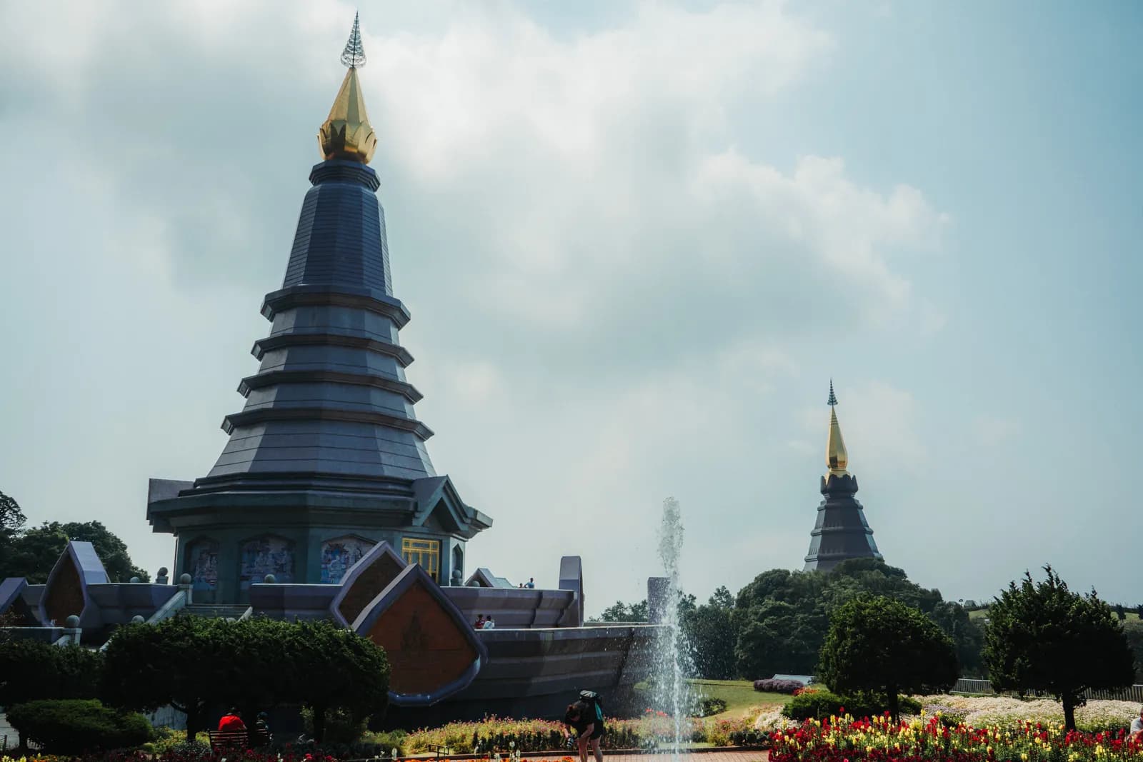
The chedis are the most photogenic moment. Their recent architecture will strike some as kitsch, but the whole scene works beautifully under a blue sky. Ang Ka is short but magnificent, and Kew Mae Pan, from November to May, turns a good day into an excellent one.
The drawbacks: more than four hours on the road, a tight day if you want to see everything, packed car parks at weekends from December to February, and a view that can vanish in the burning season.
What I liked:
- The Ang Ka cloud forest, its boardwalk and its moss-covered trunks.
- The chedi gardens in April, bursting with flowers.
- The inside of the chedi, with its painted dome and white Buddha.
- The power of Wachirathan, even at the end of the dry season.
- The blue sky above the ridge, while the plains were smoky.
What I liked less:
- The summit itself, with no view at all.
- The hours on the road: more than four hours return, with a long, winding descent.
- The hazy horizon in April: no chance of seeing far.
- The extra 100 baht for the chedis, on top of an entry fee that is already steep for foreigners.
Who is it for? Nature lovers, easy hikers and photographers, and anyone looking for a cool day out. Not for those who hate long drives, nor for a two-day stay in Chiang Mai: the old city and its temples come first.
Making more of your time in the north
Doi Inthanon fits well into a four or five-day stay in Chiang Mai, between the temples of the old city and Chiang Rai. To see where it fits in a longer trip, read my 3-month Thailand itinerary, and find all my articles in my Thailand guide.
Sources and fact-checkingInformation checked on 9 October 2026 · 12 sources consulted
- Thai National Parks: Doi Inthanon (fees, distances, trails, waterfalls)
- Thai National Parks: how to get to Doi Inthanon
- Chiang Mai Citylife: Kew Mae Pan reopens for winter (2 November 2025)
- Chiang Mai Citylife: annual closure of Kew Mae Pan during the monsoon
- Khaosod English: 3°C at the summit of Doi Inthanon (2 January 2026)
- TAT News: park opening hours (5.30am to 6.30pm)
- Wikipedia: Doi Inthanon (name, chedis, climate)
- Wikipedia: Doi Inthanon National Park (founded 1972, villages, visitor numbers)
- Thai Holiday Guide: Ban Mae Klang Luang (rice terraces, coffee)
- Olsen Tours: the Hmong market on Doi Inthanon
- Byklo: practical guide to Doi Inthanon by scooter (updated May 2026)
- Wikipedia: Wachirathan Falls

Âme Bohème exists thanks to you
Some links in this article are affiliate links. This means that if you book or purchase a product through these links, we receive a small commission, at no extra cost to you. It's thanks to this support that we can continue creating free, quality content.
You can also buy us a coffee, or follow us on Instagram and Facebook.